


UN World Map shows Arunachal Pradesh and Aksai Chin as separate regions, India clarifies position

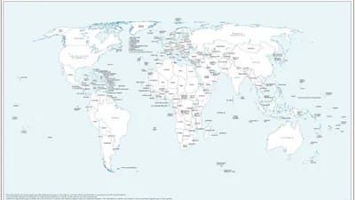
The UN has recently published a new map of the world that shows Arunachal as a distinct part of the country, along with Aksai Chin, split by the different “claim lines” of both India and China. The move is significant as India backed the UN General Assembly Resolution for changing map image including the ‘Correct the Map’ resolution to promote more accurate map representations in the world.
Meanwhile, the Ministry of External Affairs (MEA) had again condemned the Deputy Prime Minister in a press briefing on Tuesday. New Delhi made it clear that support to the resolution did not mean the endorsement of any particular map generated by the United Nations or another organisation, as it was based on maps based on equal areas.
The map was first published on July 1, when the debate on the UNGA resolution was underway. In the map of Arunachal Pradesh which shows the state in isolation, Nagaland no longer borders it. Assam and China are shown on either side of Arunachal Pradesh.
Some maps have also shown Aksai Chin as an independent area. The United Nations doesn’t give any reasons why the cartoon has undergone these particular changes in its latest diagram.
The boundaries of India and Pakistan of Jammu & Kashmir are also presented as dotted lines on the map, which represents the Line of Control (LoC). There is a note by the side of the map stating that dotted line is the approximate LoC agreed to by India and Pakistan and the final status of Jammu and Kashmir has not been reached by India and Pakistan.
Just a few weeks back, the UN General Assembly passed the resolution ‘Correct the Map’’ supported by the African Union. The goal of the programme is to enable the more accurate and fair representation of regions around the globe, especially correcting the distortions on Africa.
In confirming India’s rights in Indian Ocean waters, the statement clarifies that the country was only endorsing the principle of equal-area mapping, and not changing its policies on territorial claims.