


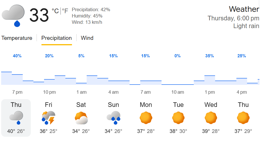
NEW DELHI – Days of heatwave-like weather witnessed a drastic turn in the form of dust storms, squalls, and rains in various areas of Delhi and the NCR region today as the atmospheric change ushered in a much-needed drop in temperature for millions who had been struggling to cope with the extreme heat, which had been hovering around 44°C to 46°C during day hours.
According to IMD, the weather phenomenon, characterized by the onset of intense pre-monsoon activities, started towards the end of the afternoon with the emergence of a wall of dark clouds over the city. An hour later, strong winds with speeds ranging from 50 to 70 km/h blew dense layers of dust over the entire region, reducing vehicular visibility drastically on all major roads in Noida, Gurugram, Ghaziabad, and the city center. Soon after the dust storm, moderate rains and lightning occurred intermittently.
This abrupt change in weather conditions was due to the presence of the new Western Disturbance over the northwest regions of India along with moisture entering the atmosphere from the Bay of Bengal.
The collision of these cooler maritime winds with the heavily baked, hyper-heated ground plains created localized low-pressure pockets, forcing convective currents that birthed towering thunderclouds.
The immediate result was an atmospheric cooling effect. Stations across the city recorded ambient temperature drops of up to 5°C to 7°C as the rain fell, temporarily suppressing the extreme dry westerlies that had traveled from the Thar Desert earlier in the week.
While the sudden squalls downed tree branches and slowed evening commuter traffic due to localized waterlogging, the overarching sentiment across the capital was deep relief. The IMD has extended a yellow alert into Friday, forecasting that the mercury will stabilize at a much more manageable 36°C over the weekend before extreme summer conditions attempt to re-assert control.
Join our whatsapp group for Latest updates
Click Here for Chhattisgarh News
Click Here for Entertainment News